

Some landscapes seem almost invented until you begin to understand what shaped them. Water deposits stone, wind rearranges sand, ice carves valleys and erosion exposes patterns that are easiest to see from space. Their strangeness is an invitation to learn something about the world rather than imagine leaving it.
These ten examples range from places with managed visitor routes to landscapes best explored through scientific images and conservation accounts. Their inclusion is not a statement about current travel access. Use the relevant local authority and your government’s travel advice before turning an interest into a journey.
1. Iceland’s volcanic and glacial landscapes
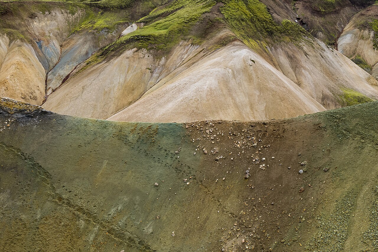
Iceland brings ice, volcanic rock and geothermal activity into close conversation. Visit Iceland’s account of Vatnajökull explains how glaciers, rivers and volcanic processes shape the national park. Elsewhere, the coloured highland hills at Landmannalaugar offer another view of the country’s varied terrain.
Avoid reducing the island to an empty, treeless world. It is a lived-in landscape with settlements and many different environments. For a visit, choose maintained routes and follow current local access information.
2. Darvaza, Turkmenistan
The Darvaza gas crater is in Turkmenistan. It became internationally known for burning gas in a desert setting, but the appearance seen in older photographs should not be treated as permanent. A 2025 Turkmen government report described work to reduce the gas supply and a decline in the visible burning.
This is an industrial and environmental story as well as a striking image. Understand that context before repeating the familiar nickname or assuming the scene will look unchanged.
3. The Richat Structure, Mauritania
From above, the Richat Structure resembles a great set of rings in the Sahara. Its shape once encouraged impact-crater explanations, but NASA’s geological account describes an uplifted dome exposed and sculpted by differing rates of erosion.
The aerial view is central to its visual effect. On the ground, the same formation reads at a very different scale. Satellite imagery is a particularly rewarding way to study its pattern and the relationship between the exposed rock layers.
4. Socotra, Yemen
Socotra’s distinctive plants, including its dragon’s-blood trees, reflect an exceptional island environment. UNESCO’s account of the archipelago emphasises its biodiversity and the many species found nowhere else. Its conservation story is at least as remarkable as its appearance.
Geography and conservation value do not establish travel suitability. The UK government’s Yemen advice, checked for this update, advises against all travel, including to Socotra. Explore the island’s natural history through authoritative conservation material rather than reading this entry as an invitation to book.
5. Río Tinto, Spain
The red-toned waters and mineral landscapes around Río Tinto have a visual force all their own. The area also has a long mining history, so its appearance should be understood through both geology and human activity. The Riotinto Mining Park provides context for a managed visit.
Choose established visitor experiences and observe their boundaries. An unusual colour is a reason to learn about the environment, not a reason to enter the water or wander into an industrial site.
6. Antelope Canyon, Arizona
Antelope Canyon’s narrow sandstone forms create extraordinary changes of light and colour. It is on Navajo land, and visits require an authorised guided arrangement. Navajo Nation Parks’ Lake Powell information should guide planning rather than an assumption that the canyon is an open-access trail.
The light in a photograph depends on time, weather and the particular part of the canyon. Treat any famous image as one moment in a place, not a guaranteed scene included with a booking.
7. Mammoth Hot Springs, Yellowstone
At Mammoth Hot Springs, heat, water and dissolved minerals create terraces that continue to change. The National Park Service’s visitor guide explains the area’s managed routes and geothermal features. The terraces’ shifting activity makes repeated images of the same location surprisingly different.
Use the boardwalks and designated paths. Looking closely from those routes allows the colours, textures and movement of water to tell the story without damaging the features or putting you in contact with thermal ground.
8. Patagonia’s glaciers
The glaciers of southern South America bring enormous scale to an otherwise familiar material. Ice changes its appearance with weather, movement and viewpoint. Argentina’s Los Glaciares National Park provides one well-documented setting in which to understand the relationship between mountains, ice and water.
Choose official viewpoints or an appropriately authorised guided experience. A distant view can make an immense glacier seem deceptively still; it does not reveal whether a particular area of ice or shoreline is accessible.
9. Grenen and the dunes near Skagen, Denmark
At Grenen, the narrow tip of northern Jutland makes land and water seem unusually close. The meeting waters are the Skagerrak and Kattegat, as Visit Denmark explains. The surrounding coast and dunes add a quieter form of strangeness to this selection.
Follow marked routes and local instructions. Watching the waves meet from the shore is quite different from entering the water, and the distinctive geography should not be mistaken for a swimming recommendation.
10. Salar de Uyuni, Bolivia
Salar de Uyuni’s immense salt landscape changes with moisture and light. A reflective surface and a dry expanse make very different pictures of the same broad setting, as NASA’s account of its seasonal flooding explains. Research the season and local conditions with an established local operator before choosing an itinerary.
Look for a visit that explains the landscape as well as photographing it. As with the other places here, understanding how it works makes the view more interesting than its resemblance to another planet.

